Climbing the Brocken is definitely something you have to do once in your life! Especially if you live in the Harz Mountains.
We (Sofia and Vanessa) have lived here for a while now and are therefore quite late. To make sure that doesn't happen to you, we've tested a route for you.
Hiking on the Goethe Trail
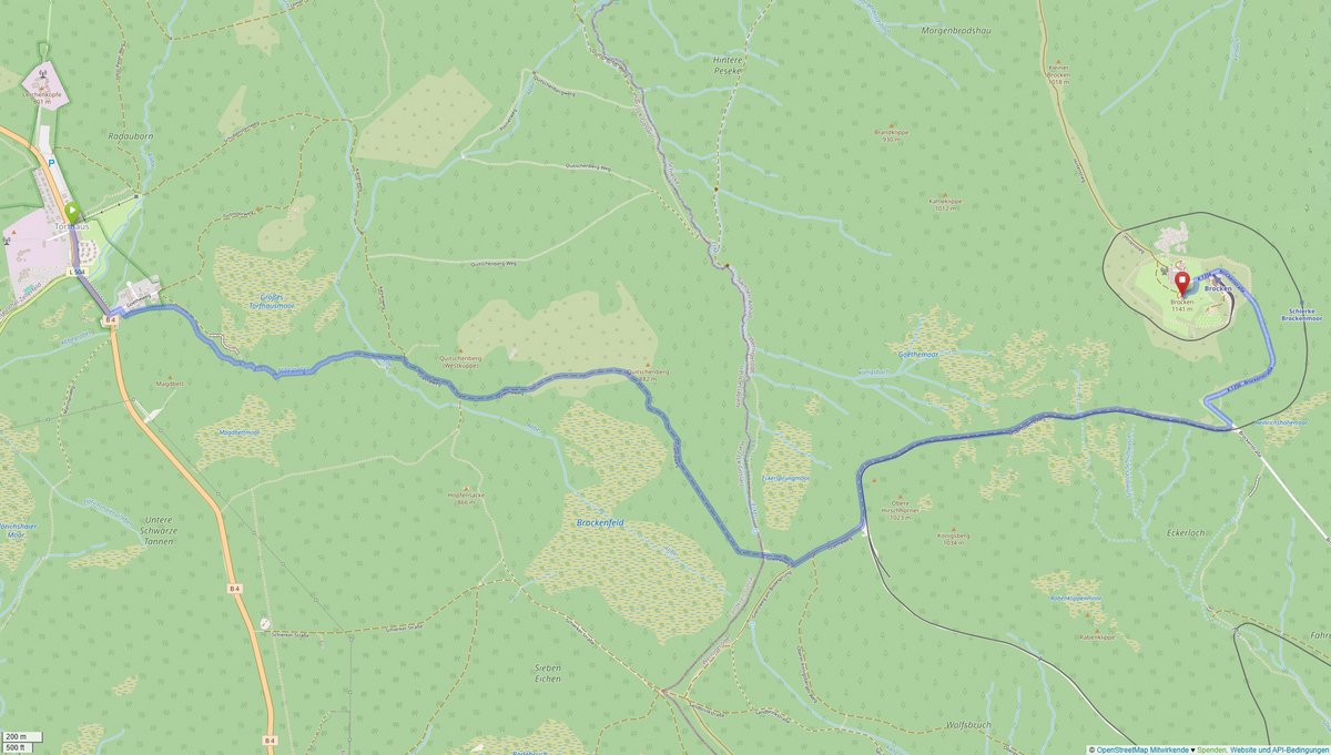
There are a total of seven routes up the Brocken, but they vary in length and difficulty. We opted for the medium-difficulty route of 16.6 kilometers (there and back) - the Goethe Trail, named after the route that Johann Wolfgang von Goethe chose from Torfhaus. Especially for us beginner hikers, the route impresses with its well-developed, wide paths and varied landscape.
Getting to Torfhaus
Don't have a car to get from Clausthal to Torfhaus? No problem. You can easily get there by public bus from the central bus station on route 840 (St. Andreasberg, Am Glockenberg). Depending on the time of day, the journey takes between 40 and 70 minutes. From the "Torfhaus" bus stop, it's just a short walk to the National Park Visitor Center, where you can use the toilet if you need to.
Please remember: it is colder on the summit - even in summer you should bring a jacket! Once you've laced up your hiking boots and equipped yourself with sun cream and a cap, you're ready to go.

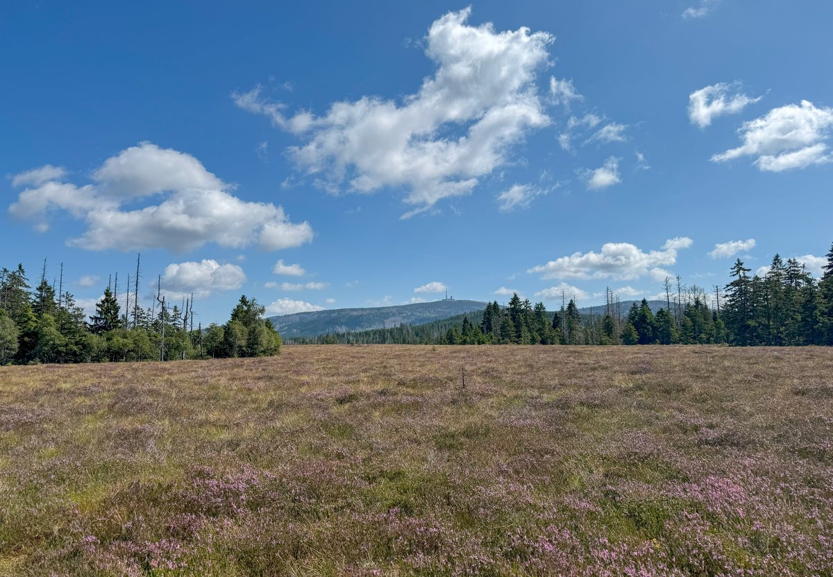
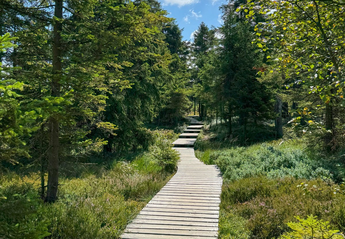
Through the Torfhausmoor
First follow the B4 for a short distance in the direction of Braunlage. After about 300 meters, turn left onto the signposted "Goetheweg" (Goethe Trail) and follow the route for a while. At the next sign, turn right and start the first section of the hike. Now you walk about one kilometer through the large Torfhausmoor, also known as Radauer Born - one of the oldest and largest moors in the Harz Mountains. Sofia likes this part of the route best. The wooden footbridge through the moor offers great photo opportunities and a magnificent view of the Brocken. The trail continues along the Abbegraben, a 1.5-kilometre-long watercourse dating back to 1827.
On the Eckersprung along the Brocken Railway
At the next fork in the path, keep right and continue along the gravel path towards Quitschenberg. If you have remembered to pack your stamp booklet for the "Harzer Wandernadel", now is your moment: here you can collect stamps 136 "Schutzhütte Eckersprung". What makes this place so special? The inner-German border used to run here. Today, a remaining safety barque is a reminder of the division of Germany.
From Eckersprung, the hiking trail climbs noticeably. After a total of 5 kilometers, you can take a break at Goethe station - there is a picture frame for photos, seating and an unobstructed view of the Brockenbahn. We were lucky: just as we arrived, the train passed by and stopped at the Brocken station - definitely one of the highlights! For Vanessa, this is where the best part of the hike begins. On the right, the tracks run parallel to the hiking trail, while on the left, the view opens up far into the valley.
The last few meters on the Brockenstraße
You reach the level crossing on Brockenstraße. Now only a few minutes separate you from the summit. The last kilometer of the hiking route is asphalted and open to pedestrians and cyclists - it can get quite crowded here, especially in good weather. Make sure you keep to the left as you climb up the road so as not to get in the way of the downhill flow of hikers. After just under 2.5 hours, 8.8 kilometers and 361 meters in altitude, you have finally reached your destination!

Arrival on the summit plateau
On the 1,141 meter high plateau, the Brockenwirt awaits you on the left with drinks, ice cream and hearty dishes. The prices for chips, bratwurst and the like are of course a little higher than in Clausthal, but are still reasonable. We paid 4.90 euros for a French fry - self-service for mayo/ketchup.
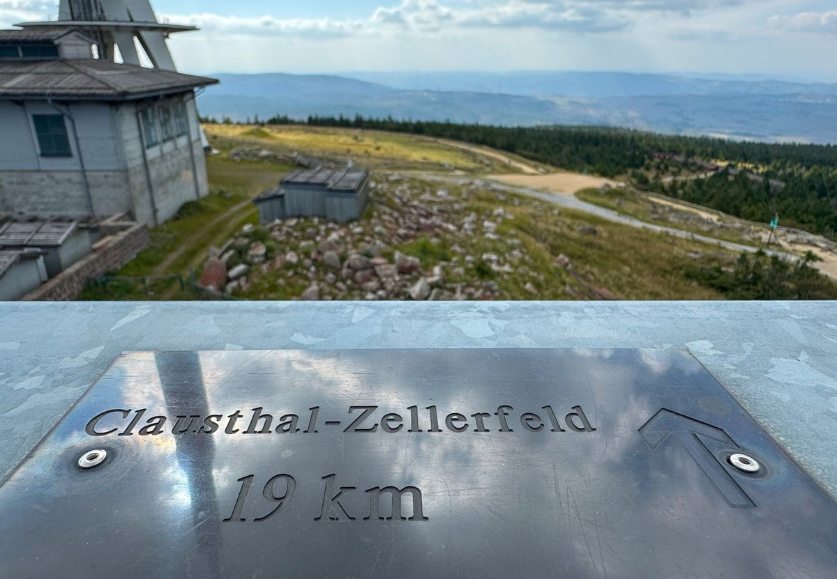
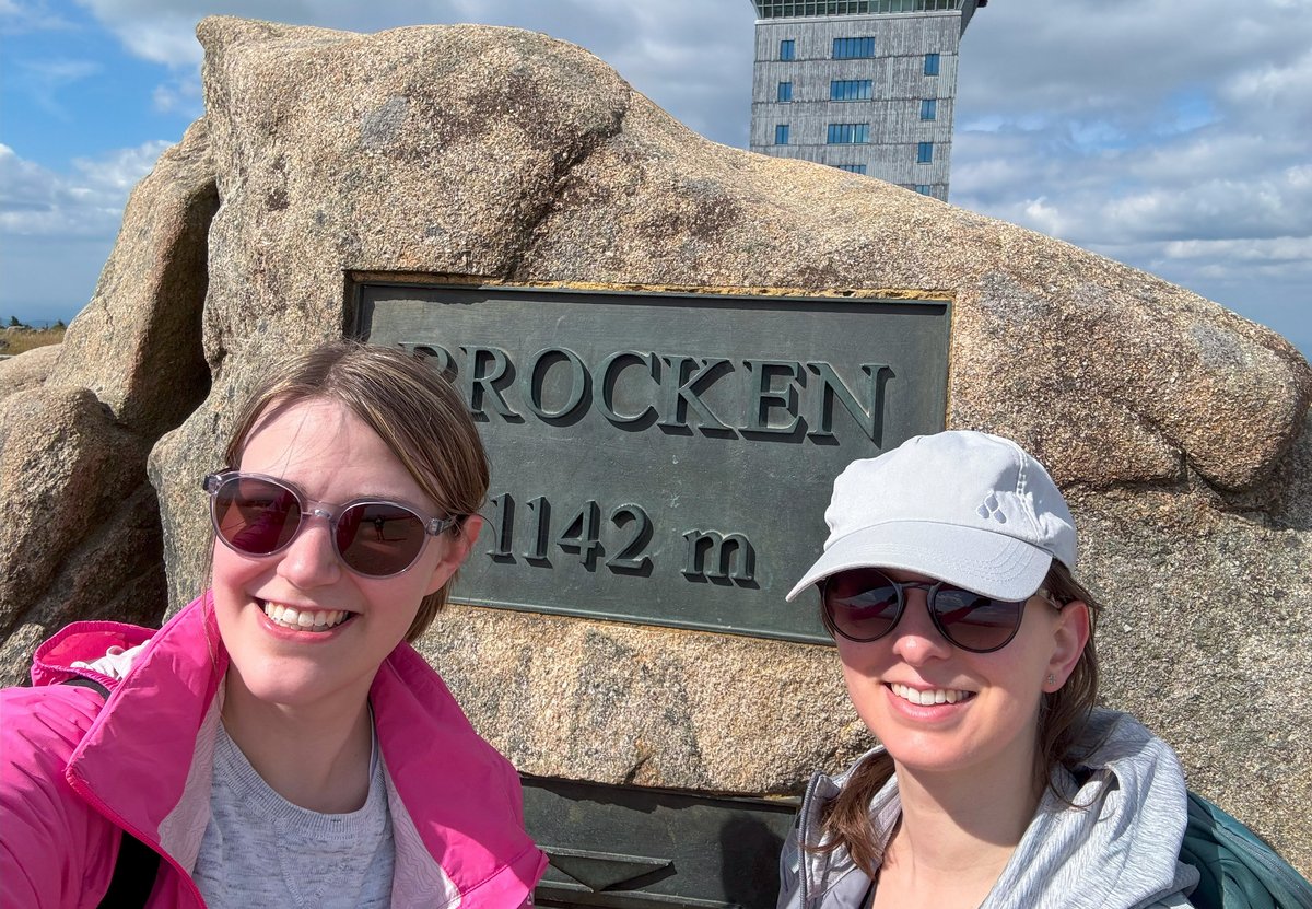
For the classic Brocken photo, however, you should go a few meters further. In the middle of the summit, framed by the Brocken Clock, stands the Brockenstein with an altitude meter plaque. You absolutely must take a photo here - proof of your successful ascent.
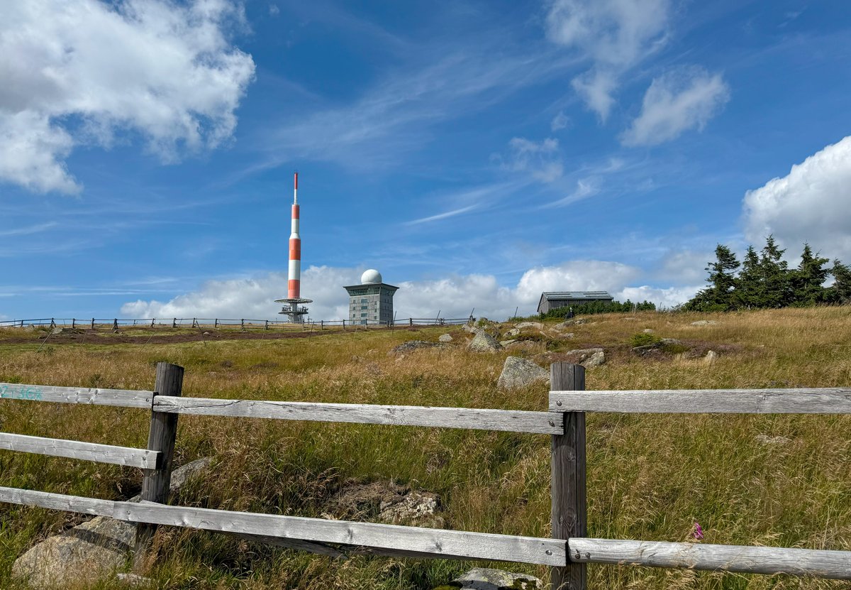
There are several buildings on the summit. The white and red transmission tower, visible from afar, is 115 meters high and serves as a transmission mast for TV, mobile telephony and radio (unfortunately not accessible). Right next to it is what used to be the oldest television tower, now the Brockenhotel. In front of it are two monuments to Heine and Goethe.
History in the Brockenhaus
Due to its location on the inner-German border, the Brocken has seen a lot. Did you know that the summit was a restricted area and used for military purposes from 1961 to 1989? You can find out more about this in the Brockenhaus, in front of whose entrance you will find stamp point 9 of the Harz Hiking Needle. You can visit the museum for seven euros: Interactive stations on the history of the Brocken await you on several floors. There are also clean toilets, a cafeteria and a viewing platform on the roof.

Around the Brocken
Even if your feet might hurt, the 1.6-kilometre circular route around the summit is worthwhile. This is where the Brocken Wall stood in GDR times. Directly behind the Brockenwirt inn, the special stamp 9944 "Brockengarten" awaits you on the right. Founded in 1890, the garden is home to more than 1,500 plant species and can be visited on a guided tour. Brocken hawkweed and Brocken anemone only grow here in Germany. The path itself is lined with dwarf shrub heath. The view is definitely worth the climb. On average, the Brocken is covered in fog 306 days a year - we were lucky with a few clouds, blue skies and sunshine.
If you go up, you have to come down
The way back to Torfhaus took us along the same route on the Goethe Trail. As we didn't set off home until 4 p.m., we had the route almost to ourselves.
Unfortunately, we therefore missed our last desired destination: The slides at the Harz Tower in Torfhaus. For an adrenaline rush at the end, you can slide down the 110-metre-long slide and take a souvenir photo. However, you should set off from the Brocken summit towards Torfhaus by 3.30 pm at the latest, as the tower currently closes at 6 pm.
And now it's your turn! We hope you enjoy your hike!
If you like the route, please give us your feedback at blog@tu-clausthal.de.